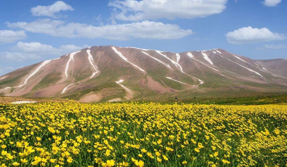
Gigantic geopark to appear on Sahand slopes

TEHRAN—Tourism authorities of the city of Maragheh plan to design a vast geopark on the southern slopes of Mount Sahand in East Azarbaijan province, northwest Iran.
Nowadays, many advanced countries with natural and cultural resources use geoparks as the main method of tourism development, Maragheh’s governor has said.
Their key function is to help local communities revive and strengthen their local and cultural identities according to sustainable development principles, IRNA quoted Davoud Asadian as saying on Monday.
There have been 36 geosites identified in the area, which together could form a geopark, the official added.
However, the assistance of the private sector is needed and welcomed, he noted.
It is believed that geoparks and geological tourism play a very important role in enhancing the quality of life of people, liberating them from poverty, and promoting economic growth, he mentioned.
Registering a geopark in the region could also increase the visits to the Maragheh fossil site, which is among the five most important and valuable vertebrate fossil sites in the world, he stated.
The fossil site of Maragheh is one of the richest fossil areas in the world, and in the last study conducted, ancestral fossils of mammoths, giraffes, and deer were found in this area.
It was found that the fossil layers in Maragheh date back to the end of the Cenozoic period, approximately seven to twelve million years ago, and that scientific exploration can provide accurate information about the lives of these gigantic animals.
As a result of the presence of mastodon and mammoth fossils (prehistory fossils), the fossil area of Maragheh has global fame and is now under the protection of the province’s Department of Environment.
As the first national, natural, and fossil remnant of Iran, Maragheh has the highest rating of environmental protection.
A geopark is a unified area that advances the protection and use of geological heritage in a sustainable way and promotes the economic well-being of the people who live there.
A number of Iranian geoparks including Tabas and Aras are in line for possible inscriptions on the United Nations Educational, Scientific, and Cultural Organization’s Global Geoparks list.
In May 2017, UNESCO included Iran’s southern Qeshm Island on its Global Geoparks list. Qeshm embraces a wide range of ecotourism attractions such as the Hara marine forests and about 60 villages dotted mostly across its rocky coastlines. The island has an abundance of wildlife, including birds, reptiles, dolphins, and turtles as well.
Tabas Geopark, which is situated in a vast county of the same name in east-central Iran, has enormous potential to be registered as “the biggest geopark” in the West Asia region.
Situated in the eastern province of South Khorasan, Tabas Geopark includes a variety of scenic landscapes and untouched terrains with the mysterious Kal-e Jeni (canyon of Jinn) located in Azmighan village, among them.
East Azarbaijan province embraces Aras Geopark which covers an area of about 1670 square kilometers, sprawling across the whole of Jolfa county. The topography is generally extremely steep and forms astonishing landscapes, so the highest point in the Jolfa region is the Kiyamaki mount with 3,347 meters and the lowest points include the northern boundary and the Aras River valley with 720 to 390 meters.
It has an appropriate geo-tourism attraction, because of its mountainous landscapes, outcropping of different sedimentary and igneous rocks, diversity in tectonic structures, semi-cold and semi-arid climate, and diverse flora and fauna.
Experts believe that the majority of geoparks help promote awareness of geological hazards, including volcanoes, earthquakes, and tsunamis, and many help prepare disaster mitigation strategies with local communities. Geoparks embody records of past climate changes and are indicators of current climate changes as well.
A UNESCO Global Geopark fosters socio-economic development that is culturally and environmentally sustainable, directly affecting the area by improving human living conditions and the rural environment. It gives local people a sense of pride in their region, strengthens public identification with the area, and promotes a better understanding of the area’s geological, natural, archaeological, cultural, and industrial heritage.
ABU/AM
Leave a Comment