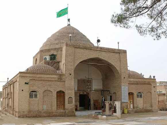
Varamin enhances preservation of historical monuments using photogrammetry

TEHRAN – In a new approach, the cultural heritage department of Varamin county has launched a photogrammetry and digitalization project for its historical monuments, using advanced global technologies.
On Sunday, the department’s head Mohammadreza Tajik announced the start of this project, saying that the initiative aims to preserve historical monuments and facilitate access to detailed information for researchers.
Tajik explained that the project will provide precise 3D scans of historical structures, enabling in-depth studies and analysis of these monuments.
The official emphasized that through this effort, the monuments will be digitally captured, processed, and reconstructed virtually.
“This approach not only enhances the preservation and maintenance of these cultural assets but also allows researchers and enthusiasts from around the world to study them more easily.”
The official said that the historical shrine of Imamzadeh Yahya had been selected for the start of the project.
Until 1220s, Varamin was an agricultural center of Ray, which is now situated in southeast of mother Tehran.
The raiding of Ray by the invading Mongols caused a flux of migration and economic growth during the subsequent Ilkhanid rule. Thus, Varamin developed into an urban center.
A Vizier of Ilkhanid Abu Sa’id, named Yusuf Quhadhi built the Jameh Mosque of Varamin. Other significant monuments from this era, include mausoleum of Imamzadeh Yahya, Aladdin Tower, Imamzadeh Shah Husayn, and Sharif mosque.
At the turn of 14th century, Varamin started to decline due to Timurid Empire armies’ invasions.
Varamin is located in the southeast of Tehran province in an even plain at a height of 918 meters above sea level.
AM
