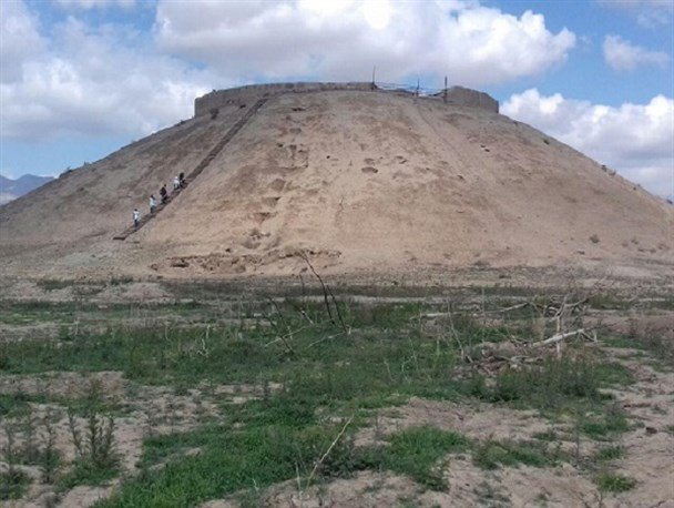
Monitoring scheme to help safeguard archeological hill

TEHRAN – Alborz province’s tourism directorate has recently installed a monitoring system for Tepe Ozbaki aimed at helping safeguard the millennia-old archaeological hill.
One of the pillars of the monitoring system is scheduled photos to be taken from specific perspectives, a provincial tourism official said.
“The most important part of the work at this stage will be monitoring the amount of erosion in different weather conditions,” the official explained.
Situated near Nazarabad, some 80 km west of Tehran, the archaeological site has yielded cultural relics dating from the first half of the 7th millennium to the first half of the first millennium BC, i.e. the Medes period.
Experts believe that the discovery of certain objects on the hill indicates some kind of commercial links to Susa in the Khuzestan region, southwest Iran.
The discovery of objects such as tablets, statuettes, and ‘jagged’ earthenware in the hill indicates some kind of a commercial link between Susa in Khuzestan and this in Tehran province, according to senior Iranian archaeologist Yousef Majidzadeh who has led excavations at Ozbaki, Qabristan and Jiroft hills.
According to the available data, the first well-documented evidence of human habitation on the Iranian Plateau was found in several excavated cave and rock shelters, located mainly in the Zagros Mountains of western Iran, dating to the Middle Palaeolithic or Mousterian period (c. 100,000 BC).
From the Caspian in the northwest to Baluchestan in the southeast, the Iranian plateau extends for close to 2,000 km. The land encompasses the greater part of Iran, Afghanistan, and Pakistan west of the Indus River, containing some 3,700,000 square kilometers. Despite being called a “plateau”, it is far from flat but contains several mountain ranges, the highest peak being Damavand in the Alborz mountain range at 5610 m, and the Dasht-e Loot east of Kerman in Central Iran, falling below 300 m.
AFM
