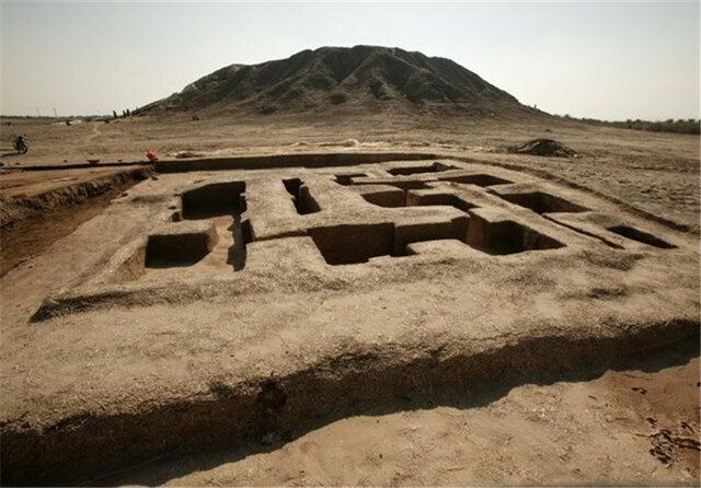
Bronze Age Konar-Sandal getting ready for UNESCO status

TEHRAN – Preparatory work has been commenced on Iran’s Konar-Sandal to get the Bronze Age site ready for a possible UNESCO registration. The site is situated in the Jiroft plain of southeastern Kerman province.
Furthermore, the archaeological site is currently being demarcated to determine its legal properties, provincial tourism chief Fereydun Fa’ali said on Friday.
A budget of three billion rials (about $71,000atthe official exchange rate of 42,000 rials per dollar) has been allocated for the demarcation project, the official noted.
He also noted that the biggest challenge in preparing the dossier for the hill’s registration is the construction of a village on the site, which needs to be carefully relocated under the supervision of the cultural heritage experts.
Based on archaeological investigations, the site consists of two mounds a few kilometers apart, called Konar Sandal A and B with a height of 13 and 21 meters, respectively. At Konar Sandal B, a two-story, windowed citadel with a base of close to 13.5 hectares was found. Tablets with scripts of unknown nature were reportedly discovered at the site.
The discovery of the magnificent Jiroft site came by accident in the very early 21st century when rounds of heavy flood along the Halil River swept the topsoil off thousands of previously unknown tombs and led to the discovery of many artifacts believed by archeologists to belong to the Early Bronze Age (late 3rd millennium BC).
Geological factors have led to it being overlooked for years by tourists and archeologists, who have generally been more interested in Mesopotamia some 1,000 km away.
Jiroft artisans fashioned pieces with what seems strange and enigmatic iconography. Some were encrusted with lapis lazuli from Afghanistan, carnelian from the Indus Valley, turquoise, agate, and other semiprecious, imported stones.
Jiroft is surrounded by mountains on three sides, rising some 4,000 meters high. Many Iranian and foreign experts see the findings in Jiroft as signs of civilization as great as Sumer and ancient Mesopotamia.
According to Encyclopedia Iranica, during the Bronze Age, the populations of the Iranian plateau bounded on the east by the Hindu Kush and the Himalayas and on the west by the lowlands of Khuzestan and Mesopotamia. There is also evidence that at the end of the 4th millennium BC settlements throughout Iran were linked in a common cultural network, the “Proto-Elamite horizon.”
The big and sprawling province is something of a cultural melting pot, blending various regional cultures over time. It is also home to rich tourist spots and historical sites including bazaars, mosques, caravanserais, and ruins of ancient urban areas.
Kerman province is bounded by the provinces of Fars on the west, Yazd on the north, South Khorasan on the northeast, Sistan-Baluchestan on the east, and Hormozgan on the south. It includes the southern part of the central Iranian desert, the Dasht-e Lut.
ABU/AFM
