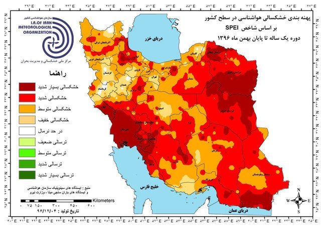
Maps for monitoring drought and crisis in natural resources developed

TEHRAN – The National Drought Warning and Monitoring Center has prepared maps for monitoring drought and crisis in natural resources across the country, ISNA reported on Thursday.
According to the Forests, Range, and Watershed Management Organization, in addition to identifying and providing information on climate change and drought trends, the maps which have been prepared in cooperation with the Meteorological Organization are used by executive agencies to take preventive measures to deal with natural threats such as fire and forest pest and diseases.
The Meteorological Organization has located some 350 precipitation gauging stations in different parts of the country to distinguish the forest and range areas facing lack of rainfall.
The aforesaid maps help the Forests, Range, and Watershed Management Organization and other related organizations with greater awareness in planning, preventing and dealing with emerging crises, also to take necessary actions.
The Meteorological Organization is currently providing seasonal reports on climate change, drought and water shortages in agriculture, henceforth the state of the country's natural resources will be added to the report.
Currently, the maps are available on the official website of the National Drought Warning and Monitoring Center.
FB/MQ/MG
