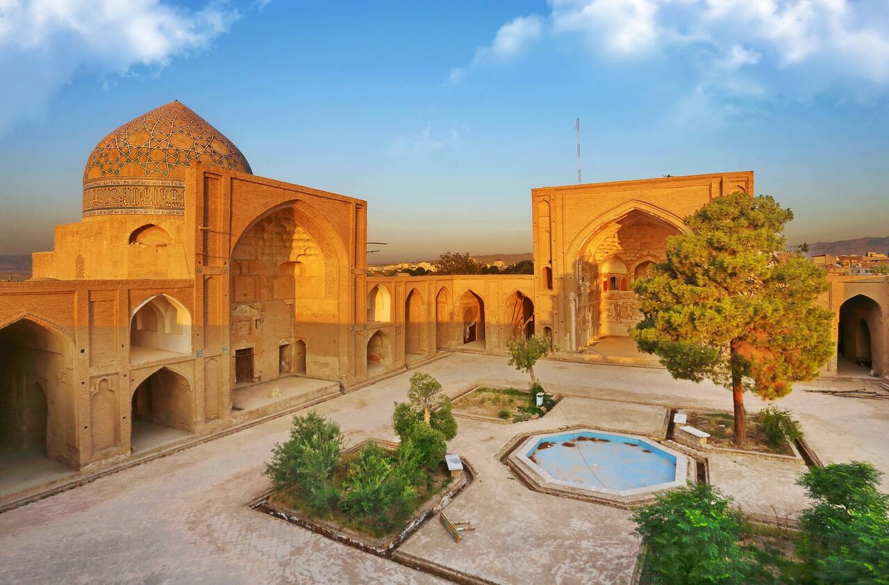
Archaeological survey underway at Saveh’s 12th-century mosque using GPR technology

TEHRAN - For the first time, archaeologists have utilized Ground-Penetrating Radar (GPR) technology to uncover potential historical artifacts at the Jameh Mosque of Saveh, which dates from the 12th century.
This innovative approach marks a significant milestone in the archaeological exploration of Iran’s Markazi province, the provincial tourism chief said on Saturday.
Mahmoud Moradi Naraqi said that the GPR survey at the Jameh Mosque of Saveh represents the province’s inaugural use of this advanced technology. Conducted in collaboration with a knowledge-based company, the GPR examination aimed to investigate the mosque’s historical layers and subterranean features.
The results of the GPR survey at the Jameh Mosque of Saveh will be presented at a technical council meeting within the Cultural Heritage Department, contributing to the ongoing studies and providing a comprehensive understanding of the site’s historical context.
Moradi Naraqi emphasized the significance of this geophysical method, highlighting its non-destructive nature and ability to deliver detailed subterranean images. “This collaboration offers us a unique opportunity to uncover and understand our historical landscape with cutting-edge technology,” he stated. “We eagerly anticipate the new discoveries that will provide valuable insights into the cultural heritage of this region.”
The Seljuk-era mosque still continues to enthrall the faithful, tourists, and enthusiasts of history and Islamic architecture alike. Its intricate architectural ensemble encompasses a courtyard, porch, minaret, dome, and two ancient altars adorned with Kufic calligraphic works.
Named after Saveh, the central Iranian city, the term “Jameh Mosque” or “Masjed-e Jameh,” or “Friday Mosque” in Iran specifically denotes a grand communal mosque designated for obligatory Friday prayers, distinctively recognized within the country and revered as a significant cultural and spiritual landmark.
GPR is a non-invasive geophysical method that employs radar pulses to create subsurface images. This technology is particularly valued in archaeology for its ability to monitor and provide 3D representations of underground features without damaging the site. The GPR survey involves emitting electromagnetic waves within the MHz range, capturing their reflections, and returning signals to the receiver to produce radiogram profiles. These profiles are then analyzed using specialized software.
AM
Leave a Comment