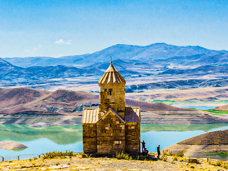
Iran’s Maku aims to establish geopark to promote sustainable tourism

TEHRAN - Maku Free Zone Organization has approved a plan to establish a geopark in the northwestern Iranian region, which possesses considerable geological and historical significance.
“In a recent meeting with the CEO of the Maku Free Zone Organization, we agreed to lunch initial studies to formulate preliminaries and needed infrastructure to launch a geopark,” Alireza Amrikazemi, who is a member of the UNESCO Global Geoparks Council, said on Tuesday.
When it comes to geological attractions, the Mako region is famed for its basaltic prism as well as arrays of massive igneous and volcanic rock features, the expert explained.
“Our [ultimate] goal is to create a joint geopark with Turkey. If this happens, we will have the first joint geopark in the Asia-Pacific region,” Amrikazemi said.
In Turkey, like in Iran, they should conduct studies and introduce them at the national level, so that we can introduce both geoparks at the international level and jointly present it for a UNESCO registration, he said.
Referring to the advantage of international registration of geoparks, Amrikazemi said: “UNESCO welcomes such cooperation. Moreover, it leads to the development of peace and friendship between countries, cultural exchanges, sharing of experiences and resources, facilitating the visit of tourists from opposite countries, unity and networking in the region.”
Maku has been established at a height of about 1300 m above sea level in a valley that passes through which the Zangmar River and divided the city into the northern and southern parts.
Maku's attractions include mountain landscapes, flowery meadows, hot springs, waterfalls, reserves, ancient churches, palaces, and hunting grounds alongside buildings.
Home to three UNESCO-registered geoparks in Qeshm, Aras, and Tabas, Iran has the potential for many other geoparks. The most prominent landmarks of the country include magma phenomena, Tectonic landforms, salt plains, erosion landforms, mountains, deserts, caves, and mud volcanoes, which in total, produce a precious body of geological forms.
According to the definition demarcated by UNESCO, a geopark is an enclosed area with determined borders that comprises several sites that possess geological significance and can play an important role in the economic development of the community nearby. Furthermore, a geopark may contain historical, ecological, archeological, cultural, and other features as well as its geological import.
Experts say geoparks help raise awareness of geological hazards such as volcanoes, earthquakes, and tsunamis, and many help develop disaster preparedness strategies in partnership with local communities. In addition, they provide records of past climate changes and are also indicators of current climate changes.
According to the UN cultural body, the UNESCO Global Geopark label is in answer to the need for global planning to recognize geologically significant sites. The UNESCO Global Geoparks aim to emphasize the value of these sites, as well as create jobs and boost the regional economy. With these ends in mind, UNESCO ratified this global label in 2015.
AFM
Leave a Comment