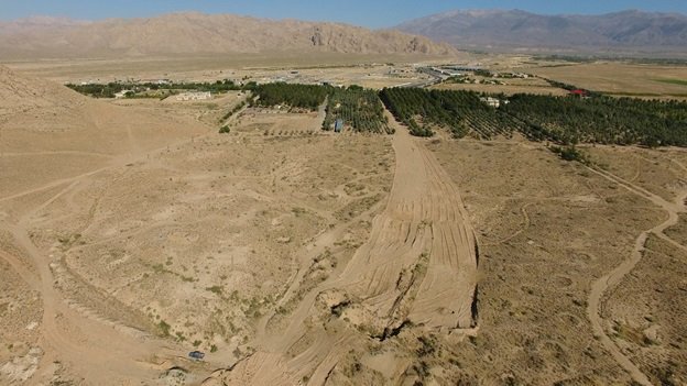
Tall-e Khakestar stratigraphy survey finds no archaeological sediments

TEHRAN – Pottery fragments, previously discovered on the surface of Tall-e Khakestar, have grabbed the attention of archeologists for years to conduct an exploratory survey on whether the north-central Iranian site is home to an ancient settlement or not.
“Situated one kilometer away from Shahroud in a northward direction, Tall-e Khakestar was named a natural cultural heritage in the year 1388 (2009). For years, however, the site has drawn the attention of archaeologists due to pottery fragments scattered on the surface,” CHTN quoted archaeologist Mostafa Rashidi as saying on Monday.
Based on recent studies and its modern morphology, this area lacks ancient deposits. And objects discovered on the surface may be due to the short-term settlement of nomadic tribes, Rashidi said.
“One of the reasons is that the site is close to a mountain terrain, and mountainous pastures could be a good choice for temporary settlement of nomads.”
The first archaeological season on the site commenced in June 2020, in which 19 trenches each measuring 1.5 meters by 1.5 meters were curved for an initial stratigraphy survey, the archaeologist said.
Although no traces of ancient deposits have been found in the layers excavated in the boreholes, the existence of surface finds, including pottery pieces, suggests the idea that this area was probably a temporary refuge for the people who left little cultural remnants, he explained.
Tall-e Khakestar is situated at the junction of Bastam and Shahroud plains, in Semnan province, he said.
Semnan is home to many ancient and prehistorical sites with Tepe Hesar being amongst the most important ones. Tepe Hesar was first excavated in 1925 and 1931-1932 when the construction of the Trans-Iranian Railway cuts through the main mound. It was one of the first Chalcolithic and Bronze Age excavations in this area, and the stratigraphy has been very important to date in similar sites.
From the Caspian in the northwest to Baluchistan in the southeast, the Iranian plateau extends for close to 2,000 km. It encompasses the greater part of Iran, Afghanistan, and Pakistan west of the Indus River containing some 3,700,000 square kilometers. Despite being called a “plateau”, it is far from flat but contains several mountain ranges, the highest peak being Damavand in the Alborz mountain range at 5610 m, and the Dasht-e Loot east of Kerman in Central Iran falling below 300 m.
The first well-documented evidence of human habitation is in deposits from several excavated cave and rock-shelter sites, located mainly in the Zagros Mountains of western Iran and dated to Middle Paleolithic or Mousterian times (c. 100,000 BC).
A 2019 study published by the Journal of Human Evolution, suggests that Neanderthals were roaming over the Iranian Zagros mountain range between 40 to 70 thousand years ago. Neanderthals lived before and during the last Ice Age of the Pleistocene in some of the most unforgiving environments ever inhabited by humans. They developed a successful culture, with a complex stone tool technology, that was based on hunting, some scavenging, and local plant collection. Their survival during tens of thousands of years of the last glaciation is a remarkable testament to human adaptation.
AFM
Leave a Comment