Why Oshnavieh is heaven for archaeologists?

TEHRAN - Having numerous gardens, Oshnavieh county, which is surrounded by towering mountains in northwest Iran, lies on a thick layer cake of civilizations that emerged and disappeared during millennia. Moreover, the county is known as the cherry capital of the country as well.
Situated in West Azarbaijan province, Oshnavieh boasts some 100 sites registered on the national cultural heritage list. It is also home to archaeological sites and hills, tomb chambers, and bas-relief carvings belonging to the Kingdom of Urartu (860 BC – 590 BC).
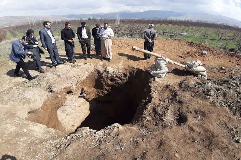
The main reason why Oshnavieh is called an archaeologist’s paradise is that it was once a prosperous settlement for the Urartu kingdom, whose entombed relics still draw the attention of archaeologists and even illegal excavators to the region.
Over the past couple of years, Oshnavieh and its surrounding areas have witnessed series of unauthorized, unprecedented drillings and excavations committed by unauthorized diggers and antique dealers, and smugglers.
The Urartu kingdom rose to power in the mid-9th century BC, but it went into a gradual decline and was eventually conquered by the Iranian Medes in the early 6th century BC. The Urartians were succeeded in the area in the 6th century BC by the Armenians.
Urartu, an ancient country of southwest Asia centered in the mountainous region southeast of the Black Sea and southwest of the Caspian Sea. Today the region is divided among Armenia, eastern Turkey, and northwestern Iran. As mentioned in Assyrian sources from the early 13th century BC, Urartu enjoyed considerable political power in the Middle East in the 9th and 8th centuries BC.
According to Encyclopedia Iranica, the territory of the ancient kingdom of Urartu extended over the modern frontiers of Turkey, Iran, Iraq, and the Republic of Armenia. Its center was the Armenian highland between Lake Van, Lake Urmia, and Lake Sevan.
Urartian archeological finds in modern Iran include castles, settlements, water channels, and other water constructions, rock chambers, rock graves, stelae, rock inscriptions, and building inscriptions.
Most impressive are the Urartian architectural remains with their different building forms and ground plans, mainly as castles and larger fortresses. They range in size from small, mostly rectangular castles or road stations to the extended fortification systems of large settlements.
Urartian pottery is mainly earthenware and, to a lesser extent, red polished ceramic, so-called palace-ware, since it is found only in the larger, central Urartian sites. Urartian pottery is mostly monochrome ware made by the potter’s wheel.
Cuneiform inscriptions have been found on clay tablets, cylinder seals, and bullae; there are inscriptions on building stones, as at Bastam and rock inscriptions, others on stelae and clay vessels.
The Urartian rock chambers influenced the Achaemenid rock graves in layout and stonecutter techniques. The monumental scale of the Urartian rock cuttings and surface preparation for cuneiform inscriptions prepared the way for the Achaemenid monumental inscriptions, in particular, that of Darius at Bisotun.
Archaeological excavations suggest that agriculture entered into a new stage owing to the practice of irrigation by Urartus in northwest Iran. Thanks to the water management exercised, the Oshnavieh plain was so productive for a long time. The water supply system realized by the Urartu in the first half of the first millennium BC has been so remarkable that the contemporaneous people imitated them.
AFM

Leave a Comment