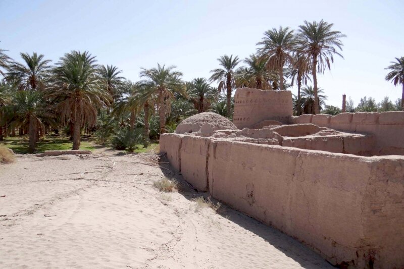
77 historical relics, sites identified in plains of Kerman

TEHRAN – A total of 77 historical relics, places, and sites, including ruined fortresses, farmhouses, (archaeological) hills, tombs (or cemeteries), kilns, solo structures, have been identified on the outskirts of Fahraj in Kerman province, southeast Iran.
“The recognized objects and palaces in Fahraj date a vast sequence of time from the Paleolithic era onwards… but the majority of which are related to the Islamic era,” archaeologist Shahram Zare’ said on Monday.
Last month, some first-hand prehistorical human settlements believed to date back to the Paleolithic era were spotted on the outskirts of Fahraj by a team of archaeologists, cultural heritage experts, and excavators.
Led by Zare’, the team launched extensive research on the eastern edge of Kerman province on the margins of the UNESCO-registered Lut desert. The research was part of a greater project, supervised by the Research Institute of Cultural Heritage and Tourism, to develop an extensive archaeological map of Iran.
Some of the most important archeological sites in the region were formed near the banks of seasonal rivers that branch off from the Nessa River.
“The invention and spread of aqueduct skill was a turning point in formation and prosperity of human settlements in this region, and [manmade] aqueducts have played a key role in the formation, and the decline of settlements in this region.”
According to him, most of the newly-identified sites are linked with the Middle Paleolithic epoch that is the second subdivision of the Paleolithic or Old Stone Age. The Middle Paleolithic broadly spanned from 300,000 to 30,000 years ago.
“Dating of these sites is being carried out based on the morphology of stone artifacts collected from the surface as well as making [direct] comparisons with similar samples [previously found] in other parts of the Iranian plateau, the ones that have been dated beforehand.”
“Most of the stone tools are made of chert and some of which are of volcanic origin, relatively severely eroded due to high-temperature fluctuations between the day and night,” Zare’ explained.
Chert is a hard, fine-grained sedimentary rock composed of crystals of quartz that are very small. Chert is often of biological origin but may also occur inorganically as a chemical precipitate or a diagenetic replacement.
Kerman province is bounded by the provinces of Fars on the west, Yazd on the north, South Khorasan on the northeast, Sistan-Baluchestan on the east, and Hormozgan on the south. It includes the southern part of the central Iranian desert, the Dasht-e Lut. The southern Lut is relatively dry and is not saline, while in the east are sand dunes and in the west, wind-carved ridges 180–240 feet (55–70 meters) high, called kalut.
According to Britannica, at sites dating from the Lower Paleolithic period (2,580,000 to 200,000 years ago), simple pebble tools have been found in association with the remains of what may have been some of the earliest human ancestors. A somewhat more-sophisticated Lower Paleolithic tradition known as the Chopper chopping-tool industry is widely distributed in the Eastern Hemisphere and tradition is thought to have been the work of the hominin species named Homo erectus. It is believed that H. erectus probably made tools of wood and bone, although no such fossil tools have yet been found, as well as of stone.
AFM/MG
Leave a Comment