Advanced digital mapping starts at UNESCO-tagged Tchogha Zanbil, Haft-Tappeh

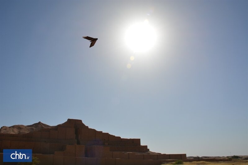
TEHRAN – A new digital mapping has been commenced at the UNESCO-registered Tchogha Zanbil and its nearby archaeological site, Haft-Tappeh, using an advanced low altitude unmanned aerial vehicle (UAV).
Digital mapping of Tchogha Zanbil and Haft-Tappeh has been commenced using an eBee Plus survey drone [which is a large-coverage photogrammetric mapping system featuring RTK/PPK upgradeability, for survey-grade accuracy on demand], director of the archaeological sites said on Sunday.
“Surveying with advanced tools provides greater speed, accuracy, and efficiency in displaying, monitoring, and documenting historic and ancient sites,” Atefeh Rashnoei added.
“Previous mappings for the sites were carried out by the means of “total station [theodolite]” that risks the possibility of errors with these cameras and it is very time-consuming….. Surveying with eBee Plus drones with the ability to access accurate three-dimensional information from the ground, which is one of the most basic spatial needs to be put on the agenda,” the official explained.
Mehdi Aalipour, a senior archaeologist who supervised the mapping projects, said: “So far, many aerial photographs and surveys have been prepared by our experts or commissioned by the private sector with aged technologies, which due to the passage of time and the possibility of errors and misinterpretation, so that was necessary to re-monitor the sites and their premises using new methods for documentation.”
“The surveys are being carried out with an accuracy of 1.500 and with a small computational error (about 5 cm) by drones and three-frequency GPS at an area of about 1500 hectares,” he said.
The recent development in aerial photogrammetry is the use of large-format digital aerial cameras for producing topographic maps, however, the cost of the camera is too expensive and many mapping organizations around the world could not afford to purchase it. This study concentrates on the use of an unmanned aerial vehicle for producing digital map. UAV has been widely used in the military for reconnaissance, planning, combat, and etc. Today, UAV can be used by civilians for reconnaissance, monitoring, mapping, and others.
“All archaeological activities, restoration works, monitoring of structures and vegetation cover are facilitated with the help of [eBee Plus drones which yield] different layers and outputs including integrated and uniform images in the form of Orthopaedic [Practice] with high spatial resolution, dense of colored dots, three-dimensional model, mosaic-shaped images, etc.,” Aalipour concluded.
Haft-Tappeh (literary meaning “Seven Mounds”) is located 15 kilometers to the south of the ancient city of Susa, itself a highly significant archeological site in southwest Iran. Early excavations in Haft-Tappeh conducted by the late Iranian archaeologist Dr. Ezzatollah Negahban yielded a large number of petroglyphs bearing cuneiform inscriptions in Akkadian, belonging to Elamite kings. The petroglyphs contain information on the religious beliefs, trading methods, and the political, cultural, and social relations of the time.
A topmost tourist destination in Khuzestan province, the magnificent ruins of Tchogha Zanbil is considered by many the finest surviving example of the Elamite architecture in the globe. It was made a UNESCO site in 1979. Its construction started in c. 1250 BC upon the order of the Elamite king Untash-Napirisha (1275-1240 BC) as the religious center of Elam dedicated to the Elamite divinities Inshushinak and Napirisha.
The ziggurat overlooks the ancient city of Susa (near modern Shush) in Khuzestan Province. Reaching a total height of some 25m, the ziggurat was used to be surmounted by a temple and estimated to hit 52m during its heyday. UNESCO says that Tchogha Zanbil is the largest ziggurat outside of Mesopotamia and the best preserved of this type of stepped pyramidal monument. Tchogha Zanbil was excavated in six seasons between 1951 and 1961 by Roman Ghirshman, a Russian-born French archeologist who specialized in ancient Iran.
AFM/MG

Leave a Comment