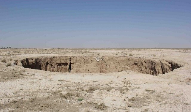
Land subsidence an overlooked threat to the country: expert

TEHRAN – Although land subsidence is too subtle to be detected, it must be tackled before incurring great loss, which has been proved to be more destructive than flood and earthquake, deputy director for Iran National Cartographic Center has said.
Land subsidence, a gradual settling or sudden sinking of the Earth's surface due to subsurface movement of earth materials is mainly caused by aquifer-system compaction, drainage and decomposition of organic soils, underground mining, oil and gas extraction, hydrocompaction, natural compaction, sinkholes, and thawing permafrost.
Recent floods were not the first natural disasters and definitely will not be the last, so we must be prepared before the incidents, IRNA quoted Yahya Jamour as saying on Tuesday.
Earthquake, land subsidence, landslide, and floods are the common natural disasters in Iran, while volcanoes can be considered a potential disaster in the country, he said.
Referring to the National Cartographic Center role in disaster management in the country, he noted that “we should not just refer to the data made by the center only after an incident happens, but we must rely on them in crisis management.”
Speaking of land subsidence as the largest known man?made changes in the physical environment, he explained that causing land to sink in some parts is sometimes overlooked as it normally takes place gradually, while almost bringing the land a permanent change resulting from massive withdrawal of underground water, oil or gas from wells.
Jamour further explained that in order to actually prevent land subsidence, having a proper knowledge of the phenomenon is a must.
“We try to have satellite data to measure the subsidence rate using a GPS network in the country’s plains, however satellite tools with high-tech capability is not affordable for Iran and what is available here are old,” he concluded.
Earlier in September 2018, geologist Mohammad Javad Bolourchi said that over 300 plains in Iran are at high risk of experiencing land subsidence, and as long as there is virtually no reduction in illegal overuse of groundwater resources, curbing subsidence will coincide with depletion of aquifers.
Studies in the Iranian calendar years 1388 (March 2009-March 2010), 1390 (March 2011-March 2012), and 1392 (March 2013-March 2014), indicated that the plains in southern Tehran are subsiding by an average of one millimeter a day (36 centimeters a year).
In the Iranian calendar year 1384 (March 2005-March 2006), the subsidence rate in Tehran plain has been measured at 17 centimeters a year, it has been measured 12 centimeters in Varamin county, in southern Tehran.
This is while the run-down in plains of Mashhad or Rafsanjan, which has set the record high for this phenomenon since the Iranian calendar year 1345 (March 1966-March 1967), is certainly higher, regarding the reduction in precipitation rate.
FB/MQ/MG
Leave a Comment